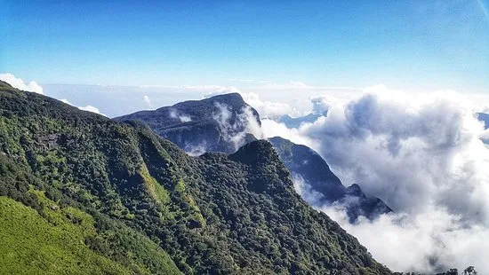
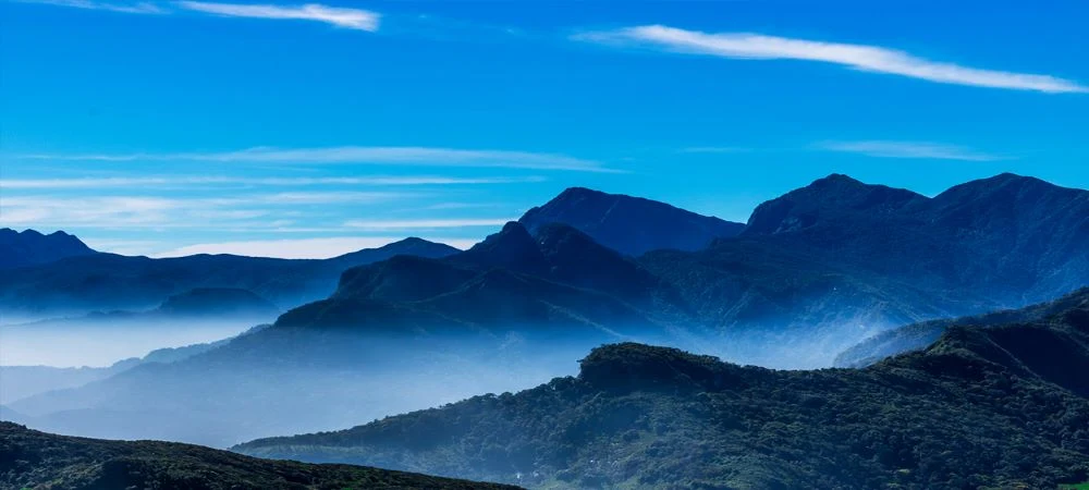
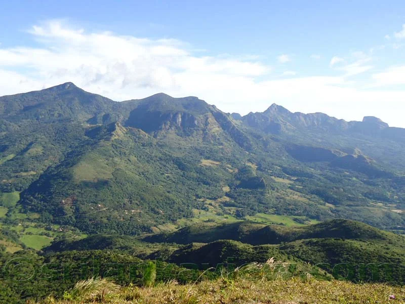
Rising majestically above the central highlands, the Knuckles Mountain Range is a UNESCO World Heritage wilderness of mist-wrapped summits, pygmy cloud forests, cascading waterfalls, and ancient secluded hamlets.
Known historically and locally as Dumbara Kanduvetiya—meaning the mist-laden mountains—the range earned its British colonial moniker from its striking resemblance to the clenched knuckles of a recumbent human fist. Stretching across roughly 234 square kilometres within the Kandy and Matale districts, this rugged conservation area shelters one of the most ecologically vital watersheds on the island, where sweeping biodiversity and untamed wilderness invite intrepid hikers into an untouched montane landscape.
Geography and Ecological Significance
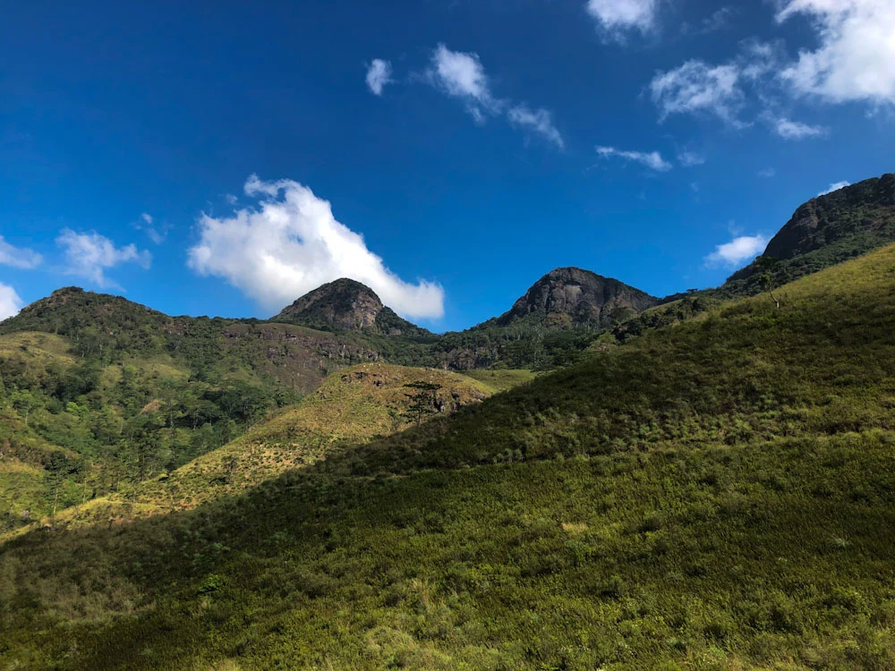
The Knuckles massif forms an isolated biological island separated from the central highlands plateau by the dramatic Dumbara Valley and the Mahaweli River basin. This geographic isolation has nurtured a distinct microclimate and evolutionary sanctuary, preserving ancient lineages of plants and wildlife that exist nowhere else on earth. The range comprises 34 prominent peaks rising between 900 and 1,906 metres above sea level, crowned by Gombaniya at 1,906 metres and the renowned Knuckles Peak itself at 1,863 metres.
Because the mountains intercept both the southwest and northeast monsoons, the topography transitions rapidly across steep elevational gradients. Valleys shift from semi-evergreen lowland scrub to dense sub-montane forests, while windswept upper plateaus support wet patanas and stunted pygmy cloud forests draped in thick blankets of moss, lichens, and miniature orchids. These ancient forests act as an enormous sponge, capturing moisture from passing clouds and feeding major river systems that sustain agriculture and life across the plains below.
Extraordinary Biodiversity and Wildlife
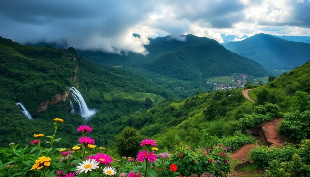
The ecological richness of the Knuckles Conservation Forest is staggering, encompassing five distinct vegetation zones and housing over 1,033 flowering plant species, including 160 species that are strictly endemic. Towering tree ferns and wild relatives of cardamom flourish in the sheltered ravines, while high ridges feature gnarled, wind-sculpted rhododendrons and carnivorous pitcher plants adapted to nutrient-poor soils.
Wildlife within the reserve is equally diverse and elusive. Dense thickets provide sanctuary for sambar deer, barking deer, wild boar, Indian giant squirrels, and the rare golden palm civet. The upper canopy shelters troops of purple-faced langurs and toque macaques, while leopards silently patrol the remote montane valleys. The Knuckles ecosystem is particularly famed among herpetologists for its relict reptiles and amphibians, most notably the Dumbara horned lizard, an endangered prehistoric-looking reptile found exclusively within this single mountain range. Avian enthusiasts can spot 128 recorded bird species throughout the forest canopy, including 17 endemics such as the elusive whistling thrush, yellow-fronted barbet, dusky blue flycatcher, and Layard’s parakeet.
Gateways and Access Routes into the Range
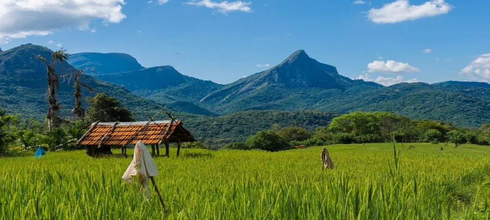
Accessing the wilderness requires navigating scenic, winding roads that climb steeply from the lowland towns. The southern gateway begins east of the historic hill capital of Kandy, following the A26 highway through Teldeniya towards Hunnasgiriya. From Hunnasgiriya, a narrow secondary road winds upward to Deanston, where the Knuckles Conservation Centre provides trail permits and visitor information, before continuing across the dramatic atmospheric pass known as Corbett’s Gap towards the eastern valley.
The northern gateway approaches the mountains from Matale via Rattota, ascending past manicured tea plantations and dramatic switchbacks towards Riverston and the Pitawala Pathana plains. A western entrance leads from Wattegama through Panwila to Bambarella, serving as a primary base for trailheads ascending the higher peaks. The pass at Corbett’s Gap sits at an elevation of 1,219 metres and offers a breathtaking natural wind funnel where cool air currents rush between jagged massifs, revealing sweeping vistas of cloud-veiled ravines and dense forest expanses.
Knuckles Mountain Range Summit & High Peaks Trek
For dedicated hikers seeking high-altitude adventure, the summit expedition to Knuckles Peak at 1,863 metres represents one of the most rewarding wilderness experiences in the country. Starting early in the morning from the western approaches near Bambarella or Wattegama, the trail begins by winding through upper tea gardens before entering the dense sub-montane forest canopy. Along the way, hikers pass rushing mountain torrents and cascading waters including Hulu River Falls and Thaliya Falls, stopping near Bambarella Falls for mid-day refreshments before entering the protected conservation core.
The ascent follows rugged, undulating paths that require scrambling over moss-covered boulder fields, navigating slippery tree roots, and traversing steep ridges. As elevation increases, the canopy shortens into the surreal pygmy cloud forest, where trees stand stunted and twisted by relentless high-altitude winds. Reaching the windswept summit ridge reveals jaw-dropping panoramic views stretching across the entire Dumbara valley, with distant mountain chains rolling toward the horizon like ocean waves. Overnight expeditions include setting up tented camps near Knuckles waterfall, where travelers unwind with fireside backwoods cooking under crystal-clear highland skies before waking to sunrise over the peaks.
Knuckles and Meemure Trekking Expedition
Hidden deep within the eastern folds of the mountain range lies Meemure, one of the most remote and traditionally preserved rural villages on the island. The multi-day trekking expedition to Meemure begins with a dramatic descent from Corbett’s Gap, leading down ancient trails formerly used by cardamom planters. Hikers follow secluded footpaths through shaded primary forests, crossing crystal-clear highland streams and passing through pristine valleys untouched by modern development.
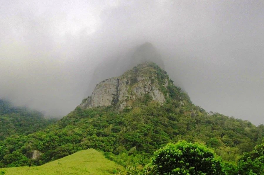
Meemure is crowned by the formidable pyramidal peak of Lakegala, a colossal granite monolith steeped in folklore as the mythical launchpad of King Ravana’s flying craft, the Dandu Monara. In the village, life continues according to centuries-old agricultural rhythms, with stone-and-clay cottages nestled amidst verdant terraced paddy fields fed by natural mountain springs. Visitors are welcomed with traditional rural hospitality, enjoying morning servings of warm Kurakkan Kanda, a wholesome porridge made from finger millet, alongside home-cooked meals prepared over wood-fired hearths. The surrounding waterways offer natural thrill, including excursions to the Seven Waterfalls point along the Meemure Oya, where trekkers can navigate natural rock water-slides and plunge into refreshing emerald river pools.
Knuckles and Riverston Trekking Expedition
The northern slopes of the range offer an entirely different highland landscape centered around the Riverston peak and the sweeping plateau of Pitawala Pathana. Accessed from Matale through Rattota, the trek begins with a scenic climb along the paved mountain pass toward the prominent telecommunication tower perched on the misty Riverston summit. Here, a notorious wind gap unleashes relentless, roaring gusts across the ridge, creating an exhilarating sensory challenge as hikers make their way toward the top.
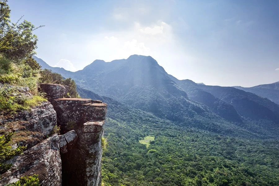
A short drive further leads to Pitawala Pathana, a rare montane grassland savannah spanning ten hectares across a gently sloping rock slab. Covered by a delicate layer of shallow turf, the plateau hosts specialized ecological communities including endemic pygmy trees, carnivorous sundews, and isolated tree frogs. The trail across the grassland terminates dramatically at Mini World’s End, where the plateau abruptly breaks into a sheer 300-metre vertical cliff plunging down into the dense canopy of the Thelgamu Oya valley below. The journey continues downhill toward Sera Ella waterfall, a powerful cascade hidden within a forested gorge featuring an unusual rock cavern directly behind its falling curtain of water, allowing visitors to walk behind the torrent.
Deanston, Southern Mini World’s End, and Nitro Caves
The southern sector of the conservation area surrounding Deanston offers accessible yet deeply rewarding walking trails suitable for casual hikers and day visitors. The headquarters at the Knuckles Conservation Centre provides informative exhibits detailing the topography, trail networks, and indigenous species of the reserve. A popular 1.1-kilometre nature trail leads from Deanston to the southern Mini World’s End escarpment, situated at an altitude of 1,192 metres.
The walk takes approximately one hour each way along a gently rising forest track bordered by towering pines and native hardwood trees. At the cliff edge, an observation platform provides dramatic views gazing out over the southern foothills, surrounding tea estates, and the expansive plains of Mahiyangana stretching into the distant mist. For more adventurous trekkers based at Deanston, a longer and more challenging trail branches eastward toward Nitro Caves, a massive subterranean cavern hidden within deep jungle. The cave earned its name from the saltpetre deposits that were historically mined from deep accumulations of bat guano during the era of the Kandyan kingdom.
Mountain Biking in Knuckles East
Beyond trekking on foot, the eastern and western peripheries of the mountain range provide world-class terrain for guided mountain biking. A classic downhill and cross-country cycling route starts approximately twenty kilometres outside Kandy, leading cyclists along tranquil paved mountain roads before branching off onto gravel trails winding through high-altitude tea plantations. The first off-road segment climbs through scenic estates toward the Elkaduwa Tea Factory, offering crisp mountain air and sweeping vistas of terraced valleys.
Riders can take an optional side excursion to Sembuwatta Lake, a serene man-made highland reservoir surrounded by towering pine forests and rolling tea gardens. The main cycling trail continues across steep climbs toward Campbell’s Lane Forest Reserve, crossing high mountain passes before descending through the historic plantation town of Madulkele. The final segment delivers an adrenaline-filled descent through rapid switchbacks down to Panwila, where cyclists conclude their journey before returning comfortably by vehicle.
Seasons, Climate, and Trekking Preparation
The climate of the Knuckles Mountain Range is notoriously volatile, capable of transforming from bright sunshine to thick, disorienting fog or torrential rainfall within minutes. Temperatures vary dramatically with elevation, ranging from warm and humid conditions in the lower river valleys to brisk temperatures dropping below ten degrees Celsius on exposed summit ridges at night.
The primary dry seasons occur from February to April and again from July to September, offering the clearest summit panoramas, firmer trail conditions, and lower rainfall. The northeast monsoon brings heavy downpours between November and January, swelling mountain waterfalls but making forest paths slick and river crossings hazardous. High winds sweep across exposed gaps like Riverston and Corbett’s Gap during the southwest monsoon from June to August.
Trekking in this untamed wilderness requires careful preparation. Hikers should wear lightweight, quick-drying clothing and sturdy, high-traction hiking boots. Because the moist forest floor harbours prolific land leeches, especially during damp periods, wearing knee-high leech socks treated with salt or insect repellent is essential. Hikers must also carry sufficient drinking water, high-energy snacks, a reliable waterproof rain jacket, and warm layers for high-elevation camping. Navigating with a certified, licensed local naturalist guide is strongly advised and in many core sectors legally required, as dense wilderness paths are largely unmarked and heavy mountain mist can obscure trails in moments.
Exploring Knuckles with Overa Tours
Whether embarking on an ambitious summit ascent, spending nights at a wilderness campsite beneath the stars, or discovering secluded cultural traditions in Meemure, the Knuckles Mountain Range stands as one of the ultimate adventure destinations in South Asia. At Overa Tours, our team designs private, tailor-made hiking expeditions featuring licensed wilderness guides, complete camping logistics, dedicated support vehicles, and curated homestay experiences.
Our bespoke highland journeys seamlessly connect high-altitude trekking in Knuckles with the cultural treasures of Kandy and the surrounding tea country. To plan your customized trekking adventure in the Knuckles range, contact our travel specialists.
Frequently Asked Questions
What is the difference between Mini World's End at Pitawala Pathana and Mini World's End at Deanston?
The Knuckles range features two distinct viewpoints named Mini World’s End. The southern Mini World’s End is accessed from the Knuckles Conservation Centre at Deanston and sits at an elevation of 1,192 metres, offering an easy 1.1-kilometre walk overlooking the southern foothills and Mahiyangana plains. The northern Mini World’s End is located at Pitawala Pathana near Riverston, where a dramatic 300-metre sheer vertical precipice plunges directly into the Thelgamu Oya river valley, surrounded by rare pygmy grasslands.
How physically demanding is trekking in the Knuckles Mountain Range?
Trail difficulty varies widely depending on the chosen route. Accessible walks such as the nature trail to Mini World’s End at Deanston or the path to Riverston summit are suitable for casual walkers and active families. In contrast, full summit ascents to Knuckles Peak or the multi-day trek to Meemure require moderate to high cardiovascular fitness, good balance, and stamina to manage steep scrambles, rocky terrain, and slippery descents across several hours of hiking each day.
How do you travel to Meemure village and can standard cars drive there?
Meemure is one of the most isolated villages in the central highlands and cannot be reached easily by standard low-clearance passenger cars. Access requires travelling from Kandy via Hunnasgiriya and Corbett’s Gap along rugged, unpaved gravel tracks with steep drop-offs and rocky surfaces. A four-wheel-drive vehicle, safari-type jeep, or high-clearance local transport is essential to navigate the descent safely.
What wildlife might hikers encounter in Knuckles, and is it dangerous?
Hikers regularly encounter vibrant birdlife, giant squirrels, purple-faced langurs, and endemic reptiles such as the harmless Dumbara horned lizard. Larger mammals including wild boar and sambar deer inhabit the forest but typically avoid humans. Encounters with wild elephants are rare and confined to the lower eastern dry margins. The most common creatures hikers encounter are harmless land leeches on damp forest trails, which can be easily managed by wearing protective leech socks.
What should hikers pack for an overnight camping trek in Knuckles?
Essential packing items include sturdy, broken-in trekking shoes with good grip, quick-drying hiking trousers, warm fleece layers for cool mountain nights, a waterproof jacket, and protective leech socks. Travelers should also pack a reliable headlamp or flashlight with spare batteries, personal toiletries, biodegradable wet wipes, a reusable water bottle, sunscreen, insect repellent, and a lightweight dry bag to protect electronics from sudden mountain mist and rain showers.
Why is it necessary to hire a licensed local guide for Knuckles trails?
The Knuckles Mountain Range is a sprawling, protected conservation forest with few marked signposts and numerous confusing animal and hunting trails. Thick mountain mist and rapid cloud cover can roll in within minutes, completely disorienting even experienced walkers. Licensed local guides not only ensure route safety and handle forest department permissions, but also possess deep knowledge of endemic wildlife, edible plants, water sources, and local village customs.